La Niña expected to end this spring: How will it impact severe weather in Indiana?
March 9, 2025
Severe weather season has begun. We are tracking the potential forecast changes for tornadoes, hail, wind, and flooding for Indiana as La Niña likely ends.
INDIANA, USA — Indiana is likely transitioning out of a weak La Niña pattern this spring, which could have significant impacts on our severe weather season.
Quick Look: As surface ocean water temperatures warm in the eastern Pacific, we expect early spring to bring more tornadoes, with flooding potentially posing a higher risk through all of Spring this year.
For the latest local short-range severe weather forecast, tap HERE.
How La Niña’s End Impacts Severe Weather
This winter’s weak La Niña brought notable snowfall to the Ohio River Valley and record snows along the Gulf Coast. Meanwhile, Northern Plains states faced a snow drought. However the snow season is not done yet, especially up north.
With La Niña ending and the Pacific entering a neutral phase, Indiana could see shifts in tornado, hail, wind, and flooding risks.

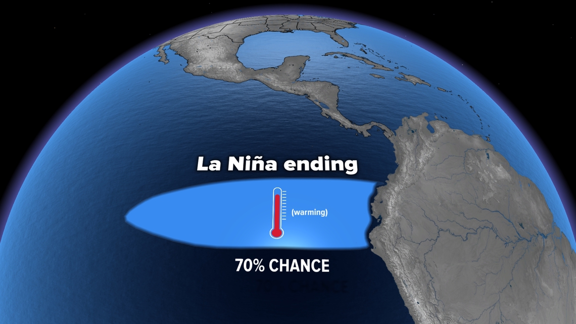
We measure La Niña by averaging surface ocean water temperatures in the eastern Pacific. Through winter, they averaged around -0.5 degrees Celsius. That is considered a very weak La Niña. We expect them to slightly warm to near -0.2 degrees Celsius this spring. That doesn’t sound like a lot, but that enters us into a ENSO neutral phase.
We analyzed all the years since 1980 that started with weak La Niña phases and entered into a more neutral phase. We averaged these years and contrasted them to average severe weather statistics to see if there were increases or decreases in those seasons. We took a look at statewide data. What you experience in your county may be different.
Severe Weather in Indiana: What to Expect by Month
Indiana’s peak severe weather season spans March through June. On average, the state records:
-
March: 2-3 tornadoes
-
April: 3-4 tornadoes
-
May: 5 tornadoes
-
June: 5 tornadoes
2025 Indiana Tornado Forecast

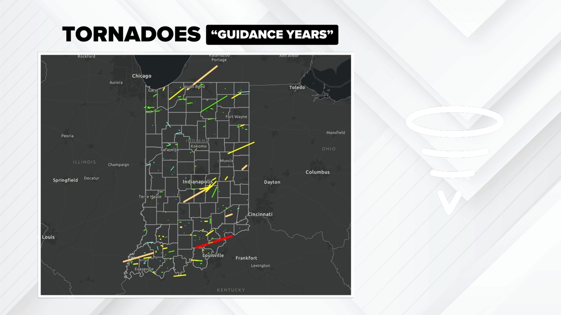
Based on years when a weak La Niña transitioned to a neutral phase (1986, 1996, 2001, 2006, 2009, 2012, 2014, 2017, 2018), we expect the following:
-
March: 3-4 tornadoes (+1 above average)
-
April: 8-9 tornadoes (+5 above average)
-
May: 5 tornadoes (average)
-
June: 2-3 tornadoes (-3 below average)
Many of these guidance years showed more tornadoes earlier in spring, with quieter conditions by summer.
One of the most notable tornadoes during these years was the 2012 EF-4 Henryville tornado.
Forecast Summary: Possibly expect a busier March and April for tornadoes, with activity tapering off sooner than usual. The rest of the year may be fairly quiet.
2025 Indiana Hail Forecast

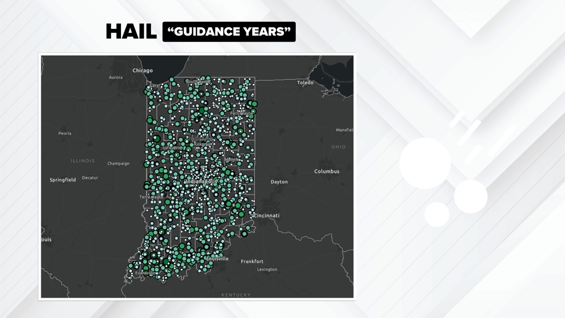
Data since 2000 (data are less reliable before 2000) shows an uptick in severe hail reports during guidance years:
-
April: 76 hail reports (+72% increase from average)
-
May: 54 hail reports (+4% increase from average)
-
June: 47 hail reports (+18% increase average)
Forecast Summary: Possibly expect above-average hail activity this spring, especially in April.
2025 Indiana Wind Forecast

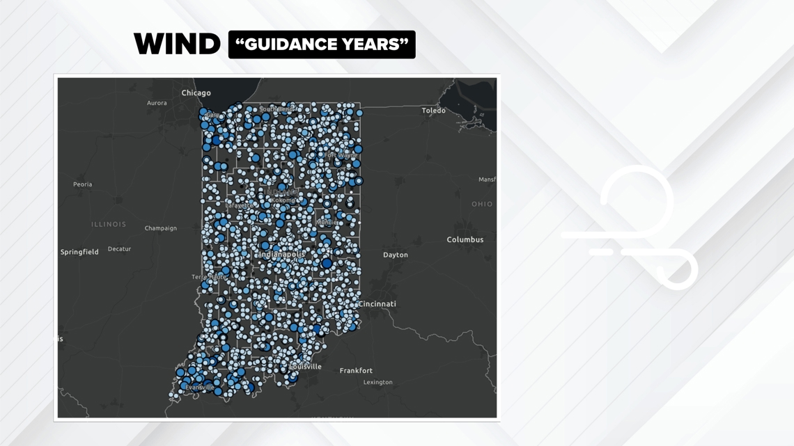
Wind damage reports during guidance years since 2000 (data are less reliable before 2000) show a slight decrease:
-
May: 61 wind damage reports (-11% decrease from average)
-
June: 85 wind damage reports (-15% decrease from average)
-
July: 82 wind damage reports (-11% decrease from average)
Forecast Summary: Possibly expect slightly fewer damaging wind events than normal.
2025 Indiana Flooding Forecast
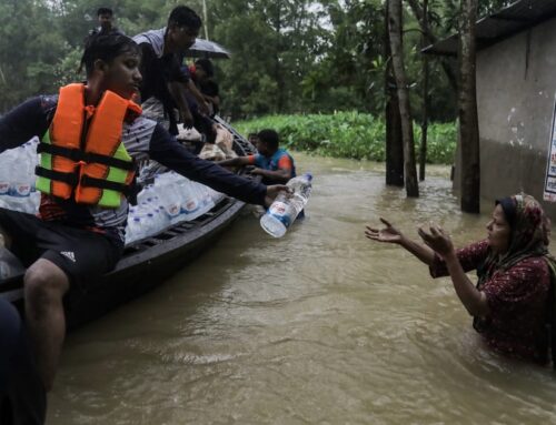
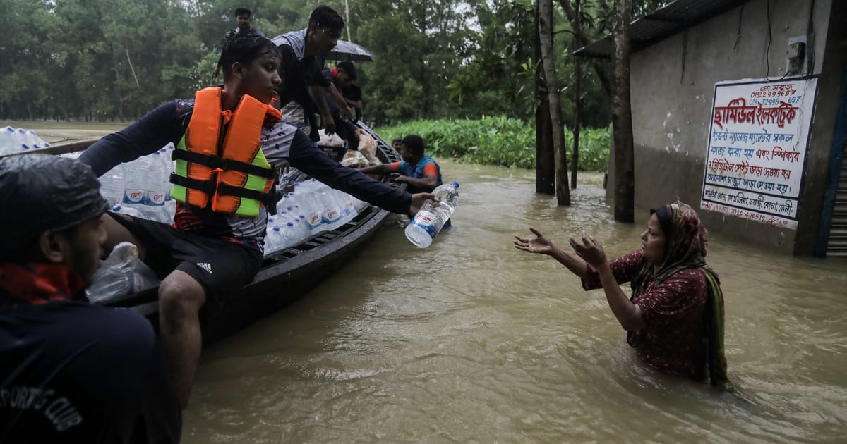
Flooding poses a serious threat during La Niña-neutral transitions. Data shows 78% of guidance years experienced higher-than-normal rainfall, particularly in central and southern Indiana.

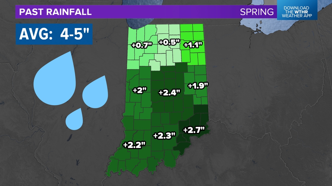
We have chatted with the National Weather Service and they are concerned about increased flooding risks across Indiana. Flooding is the second deadliest weather disaster.
Flooding can have a major impact on the Indiana agricultural economy, especially in late Spring. Ponding and rushing waters can wash away nutrients from crop fields and drown young corn and soybean plants. Farmers need to expect a higher risk for flooding this year.
Forecast Summary: Expect above-average rainfall, with an increased risk of flooding, especially in central and southern Indiana.
Indiana’s 2025 Severe Weather Outlook
Indiana’s severe weather season may start strong with a higher tornado risk in March and April, increased hail chances in April, and fewer damaging wind events overall. However, flooding risks will be heightened, so Hoosiers should stay alert.


The Climate Prediction Center releases weekly and monthly outlooks for temperature and rainfall as well, which will have more up-to-date information as the season wears on.
What will happen this year? No one knows for sure. However we can look back and see what has happened in the past. It doesn’t always pan out that way, but it’s the best guess we can have. History can give us a clue to the future.
For the latest updates, stay with the 13News Weather Team as we track storms throughout the season.
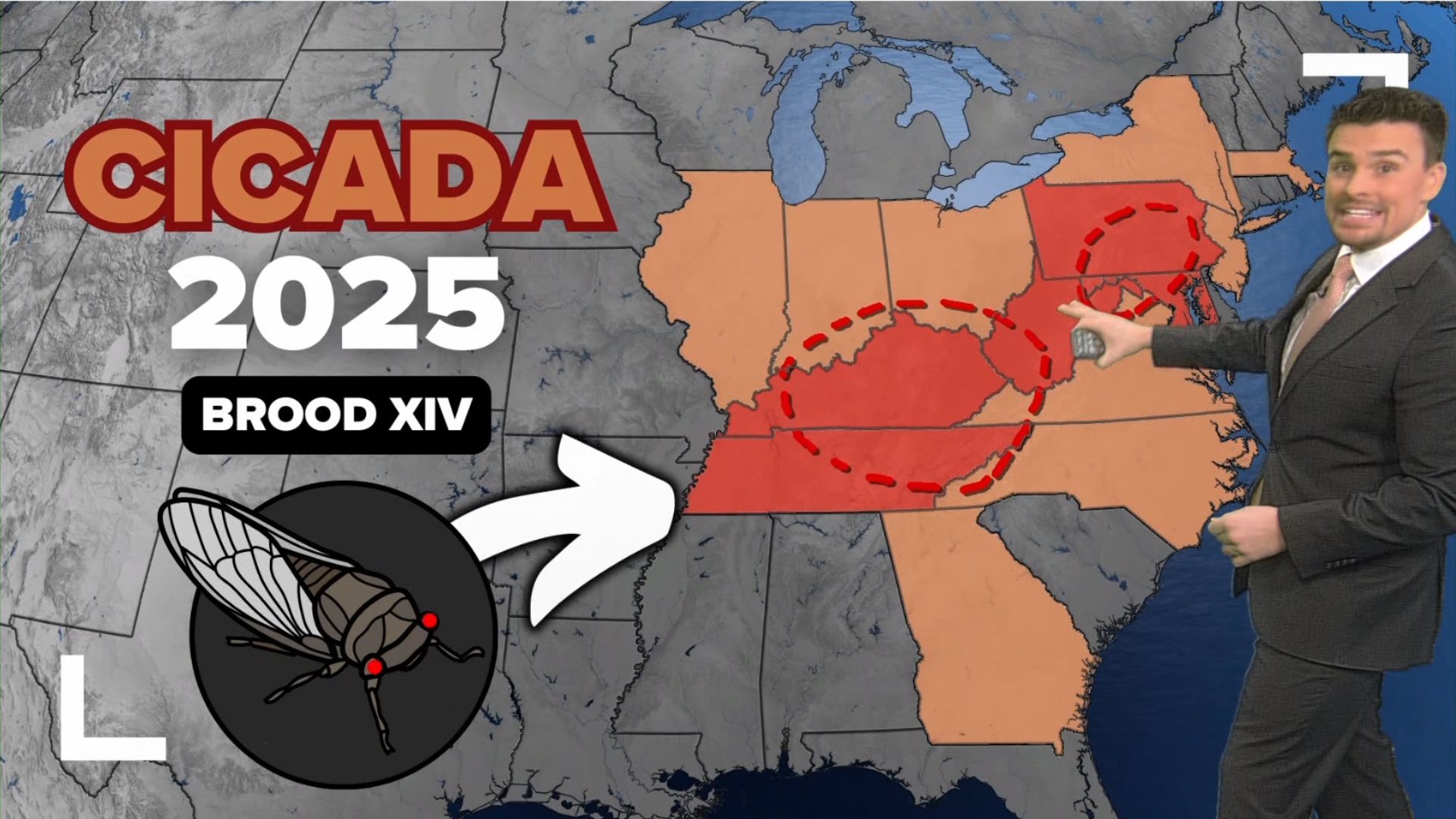
Not only are we forecasted severe weather, but also cicadas for parts of Indiana for Spring 2025.
Search
RECENT PRESS RELEASES
Related Post

