Updated fire maps show growing risk for San Diego’s urban areas
March 28, 2025
The Office of State Fire Marshal this week released updated Fire Hazard Severity Zone maps for San Diego County, showing an increase in areas designated as “very high” fire risk.
This is the first update in 14 years.
State Fire Marshall Daniel Berlant said it took time to build an accurate model.
“We worked several years to build the science and the technology to better and more accurately reflect the level of hazard that exists across San Diego and across all of California,” he said. “And so this map is really reflective of the experiences of the fire conditions that we have been seeing.”
San Diego County saw a 26% increase in the “very high” hazard zone, going from 646,838 acres to 871,212, and more urban areas are designated as “very high” for the first time.
“While San Diego has experienced wildfires for decades, but many of them in the back-country and burning right up to some of the neighborhoods right on the edge,” Berlant said. “We’re seeing more and more areas that are typical urbanized areas be impacted by wildfires. The Eaton Fire, the Palisades Fire in L.A., just a couple of months ago, show that in real time.”
Carlsbad was one of the urban areas that saw an increase. The city’s “very high” hazard zone went from 4,840 acres in 2011 to 8,170 acres. The city’s fire marshall, Darcy Davidson, said the increase was not surprising and the map accurately reflects the conditions firefighters are seeing.
Moreover, the maps will help the city identify those high-hazard areas.
Map not displaying correctly? Click here.
“So we can focus our energies on those areas where we have a higher hazard,” she said.
Carlsbad was no stranger to urban wildfires. In 2014, the Poinsettia Fire destroyed eight homes, an 18-unit condo complex and several businesses.
Fran Devlin was one of the people evacuated in that fire. Some of his neighbor’s homes were destroyed.
“They didn’t shut the window. They just left the screen,” he said. “The ember just kinda flew, got through the screen, landed on the carpet and then (swoosh).”
Berlant said that’s part of the reason why more urban areas are now labeled “high risk.”
“Many of the wildfires we’ve been seeing embers are flying from these fires upwards of a mile away,” he said. “And so that means that we’re seeing a lot more urbanized areas be considered in a fire hazard area because of the flying embers.”
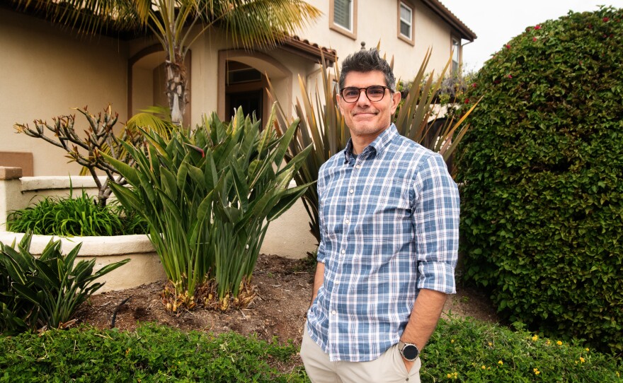
Devlin was also concerned about the implications for his home insurance. His house is in the “very high” hazard area.
“A lot of us have been dropped by our homeowners policyholders,” Devlin said. “I was with the same company for 18 years, and they just dropped me for fire hazard a year-and-a-half ago.”
He was able to find another carrier, but this year, his insurance increased 42%, from around $5,000 to nearly $7,000.
“My hope is that the idea that it’s allocating better resourcing to these areas with canyons, ‘Does that eventually kind of nullify this concern of the insurance companies looking at it as higher risk?'” Devlin said. “Or do they start to look at it like, ‘Well, maybe this allocation of resources, potentially, you know, levels out the level of risk or improves the risk.'”
He’s already taking steps to mitigate the fire danger, such as removing his palm trees and hardening his home.
Berlant said the maps are meant to help cities and counties plan new communities and should not affect the insurance rates of existing homes.
“There’s really no direct impact that these maps are going to create into insurance decision-making because insurers already know the level of risk that’s out there,” he said. “And again, they’re using such more complex modeling than this map uses.”
He said these maps are planned to be in use for 30 to 50 years.
Local cities have 120 days to adopt these maps, and they need to go into effect no later than July 31.
Search
RECENT PRESS RELEASES
Related Post


