Winter storm warning for Toronto on Sunday
January 24, 2026
An orange winter storm warning is in effect for Toronto and all of southern Ontario ahead of the next blast of winter weather on Sunday.
Environment Canada says snowfall amounts of between 20 and 40 cm are possible in some areas, and visibility will be near zero at times due to wind gusts of up to 50 km/h, making travel hazardous.
An orange alert is issued when severe weather is likely to cause hazardous conditions and disruption.
Areas closer to the lakeshore, including downtown Toronto, are expected to see the highest accumulations as winds off the lake will create a “snow snake” that is expected to enhance snowfall totals. Because temperatures will remain extremely cold, Sunday’s light, fluffy snow will easily be blown around, potentially reducing visibility and complicating travel.
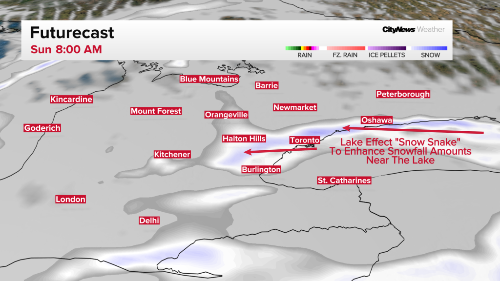
“Lake effect snow caused by easterly winds off Lake Ontario will develop early Sunday morning, producing localized heavy snowfall and reduced visibility,” says Environment Canada.
“By Sunday afternoon, snow is expected to become more widespread as a larger system moves into the area. As this occurs, lake enhancement is likely, which will lead to locally higher snowfall amounts in certain areas.”
“Prepare for quickly changing and deteriorating travel conditions.”
The lake-effect band will continue to produce very heavy, possibly whiteout conditions, well into Monday morning.
Similar orange warnings are in effect for Mississauga, Brampton, Vaughan, Richmond Hill, Markham, Burlington, Oakville, Pickering and Oshawa.
Search
RECENT PRESS RELEASES
Related Post


